This week we added maps to our Commons Explorer, and it’s proving to be a fun new way to find photos.
There are over 50,000 photos in the Flickr Commons collection which have location information telling us where the photo was taken. We can plot those locations on a map of the world, so you can get a sense of the geographical spread:
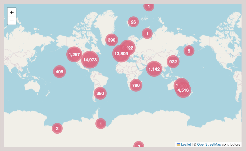
This map is interactive, so you can zoom in and move around to focus on a specific place. As you do, we’ll show you a selection of photos from the area you’ve selected.
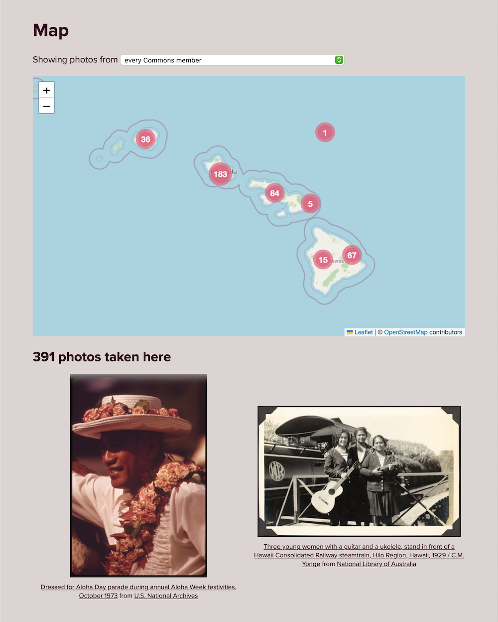
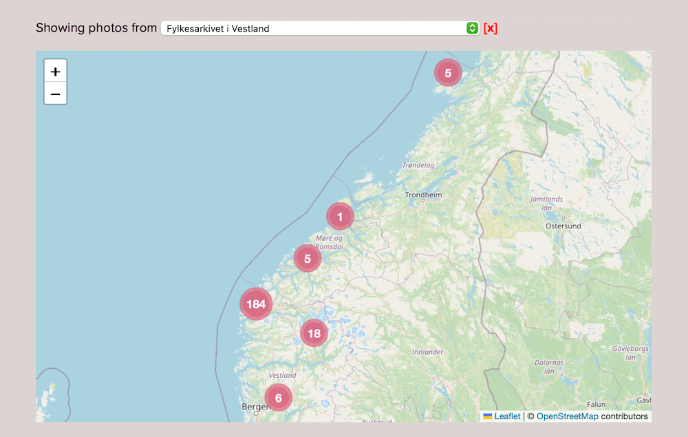
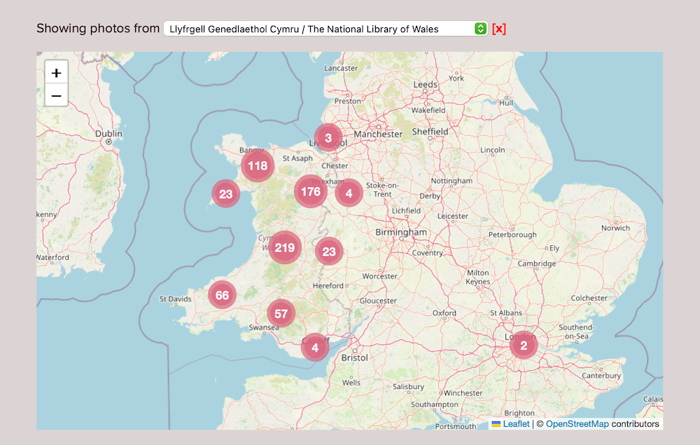
You can also filter the map, so you see photos from just a single Commons member. For smaller members the map points can tell a story in themselves, and give you a sense of where a collection is and what it’s about:
These maps are available now, and know about the location of every geotagged photo in Flickr Commons.
How can you add a location to a Flickr Commons photo?
For the first version of this map, we use the geotag added by the photo’s owner.
If you’re a Flickr Commons member, you can add locations to your photos and they’ll automatically show up on this map. The Flickr Help Center has instructions for how to do that.
It’s possible for other Flickr members to add machine tags to photos, and there are already thousands of crowdsourced tags that have location-related information. We don’t show those on the map right now, but we’re thinking about how we might do that in future!
How does the map work?
There are three technologies that make these maps possible.
The first is SQLite, the database engine we use to power the Commons Explorer. We have a table which contains every photo in the Flickr Commons, and it includes any latitude and longitude information. SQLite is wicked fast and our collection is small potatoes, so it can get the data to draw these maps very quickly.
I’d love to tell you about some deeply nerdy piece of work to hyper-optimize our queries, but it wasn’t necessary. I wrote the naïve query, added a couple of column indexes, and that first attempt was plenty fast. Tallying the locations for the entire Flickr Commons collection takes ~45ms; tallying the locations for an individual member is often under a millisecond.)
The second is Leaflet.js, a JavaScript library for interactive maps. This is a popular and feature-rich library that made it easy for us to add a map to the site. Combined with a marker clustering plugin, we had a lot of options for configuring the map to behave exactly as we wanted, and to connect it to Flickr Commons data.
The third is OpenStreetMap. This is a world map maintained by a community of volunteers, and we use their map tiles as the backdrop for our map.
Plus ça Change
To help us track changes to the Commons Explorer, we’ve added another page: the changelog.
This is part of our broader goal of archiving the organization. Even in the six months since we launched the Explorer, it’s easy to forget what happened when, and new features quickly feel normal. The changelog is a place for us to remember what’s changed and what the site used to look like, as we continue to make changes and improvements.